
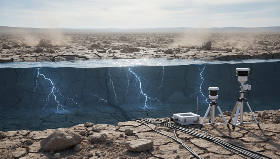
Seismic activity refers to the frequency, type, and size of earthquakes and related ground movements occurring within a specific region over a given time period. This phenomenon encompasses everything from tremors so subtle they require sensitive instruments to detect to catastrophic quakes that reshape landscapes and communities. Understanding seismic activity isn’t merely an academic exercise. It forms the foundation for earthquake early warning systems, building codes that save lives, and hazard assessments that guide where and how we construct our cities.
The ground beneath our feet, despite feeling solid and stable, exists in constant motion. Tectonic plates drift, fault lines accumulate stress, and energy releases in sudden ruptures we experience as earthquakes. But seismic activity extends beyond natural tectonic processes. Induced seismicity, caused by human activities such as fluid injection for oil and gas operations or reservoir impoundment, has emerged as a significant area of study and concern. On the opposite end of the spectrum, micro-seismicity, generally defined as seismicity of magnitude less than 3, provides researchers with crucial data about stress patterns in the Earth’s crust, often serving as an early indicator of larger events to come.
Modern seismic monitoring has transformed our relationship with these geological events. Natural Resources Canada, for instance, has issued guidance on earthquake early warning systems designed to protect people and infrastructure from earthquakes. Canada’s National Building Code incorporates seismic hazard maps that estimate risk levels across different regions, demonstrating how scientific understanding translates directly into practical safety measures. This article examines what drives seismic activity, how scientists categorize and measure it, and why these insights matter for communities worldwide.
What Seismic Activity Means
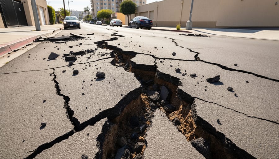
Seismic activity describes the movement and release of energy within Earth’s crust. When stress builds up in rocks along fault lines or beneath volcanoes, that energy eventually breaks free, sending vibrations called seismic waves through the ground. These waves are what we experience as earthquakes, tremors, and ground shaking.
The process starts deep within Earth’s structure. Tectonic plates, massive slabs of rock that form our planet’s outer shell, constantly shift and grind against each other. Where they meet, stress accumulates over years or centuries. When the rocks finally fracture or slip, the stored energy radiates outward in all directions. The speed and pattern of these waves depend on the materials they travel through, giving seismologists a window into Earth’s hidden layers.
- Seismic activity
- The movement and energy release within Earth’s crust that produces ground vibrations, including earthquakes, tremors, and volcanic movements.
- Seismicity
- The frequency, type, and size of seismic events occurring in a particular region over time.
- Seismic waves
- Energy waves that travel through Earth’s interior and along its surface after an earthquake or other seismic event, detected by instruments as ground motion.
- Induced seismicity
- Seismicity caused by human activity, including operations like hydraulic fracturing, reservoir filling, mining, and geothermal energy extraction.
Natural seismicity arises from geological forces. Tectonic earthquakes occur where plates collide, pull apart, or slide past each other. Volcanic seismicity results from magma movement and pressure changes beneath volcanic systems. Both types have shaped Earth’s surface for billions of years.
But not all ground movement comes from natural sources. Induced seismicity refers to seismicity caused by human activity. Industrial operations can alter underground pressures and fluid distributions enough to trigger earthquakes. Researchers have documented this connection through careful monitoring of regions where such activities occur.
Seismologists view seismic activity as more than just a hazard to manage. Each earthquake sends signals through Earth’s interior, and those signals reveal information about rock composition, temperature, and structure at depths we can’t directly reach. By analyzing how waves speed up, slow down, or bend as they travel, scientists map the planet’s hidden architecture and better understand the forces that continue to reshape our world.
How Seismic Activity Works
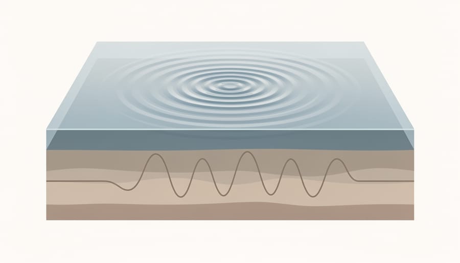
Seismic activity begins with stress accumulation deep within Earth’s crust. As tectonic plates grind against one another or pull apart, tremendous forces build up in the rocks along fault lines. These crustal rocks behave elastically under stress, deforming like a compressed spring until they reach their breaking point. When the stress exceeds the rock’s strength, the fault ruptures suddenly, and the stored energy releases in an instant. This process, called elastic rebound, sends vibrations radiating outward from the rupture point in all directions.
The released energy travels through Earth as seismic waves, which fall into two main categories based on how they move. Body waves propagate through the planet’s interior and arrive first at distant monitoring stations. Primary waves (P-waves) compress and expand rock in the direction of travel, moving fastest through solid rock, liquid, and gas. Secondary waves (S-waves) shake rock perpendicular to their direction of movement and travel only through solids, which is why they cannot pass through Earth’s liquid outer core. Surface waves follow, traveling along the planet’s outer layer and typically causing the most destructive ground shaking during large earthquakes.
The relationship between fault movement and ground shaking depends on several factors. Larger ruptures release more energy, producing stronger shaking over wider areas. The depth of the rupture matters too. Shallow earthquakes often cause more intense surface shaking than deep ones of the same magnitude because the waves travel a shorter distance before reaching the surface. The type of rock through which the waves pass also influences shaking intensity, as soft sediments amplify waves while hard bedrock transmits them more efficiently.
As seismologist Dr. Susan Hough explains, “The physics of earthquakes involves a cascade of energy transformations, from the slow buildup of tectonic stress over decades or centuries to the explosive release that lasts only seconds.” Understanding these mechanisms helps scientists predict how seismic energy will affect different locations and structures, informing everything from building codes to emergency response planning.
Types and Classifications of Seismic Activity
Natural Seismicity
Natural seismicity originates from Earth’s internal geological processes, primarily the movement of tectonic plates and volcanic activity. The vast majority of earthquakes occur along plate boundaries where massive crustal sections collide, pull apart, or slide past one another. When stress accumulating along these fault zones exceeds the strength of the rock, it fractures suddenly, releasing energy as seismic waves.
Tectonic earthquakes dominate the seismic landscape. Subduction zones, where one plate dives beneath another, generate the planet’s most powerful earthquakes. Transform boundaries like California’s San Andreas Fault produce moderate to large earthquakes as plates grind horizontally. Even continental interiors far from plate edges experience occasional seismicity when ancient faults reactivate under regional stress.
Volcanic seismicity provides a distinct signature. Magma movement beneath volcanoes creates swarms of small earthquakes and sustained tremor as molten rock fractures surrounding rock and pressurizes chambers. These seismic patterns help researchers monitor volcanic unrest and forecast potential eruptions.
Gravitational collapse in limestone caves or old mines triggers another category of natural seismicity, though these events typically remain small and localized. Understanding these natural mechanisms helps scientists distinguish tectonic processes from human-caused seismicity, essential for accurate hazard assessment and public safety planning.
Induced Seismicity
Induced seismicity refers to seismic activity caused by human actions that alter stress conditions in the Earth’s crust. Unlike natural earthquakes driven by tectonic forces, these events result from industrial activities that inject fluids underground, change subsurface pressures, or remove material from the earth.
Hydraulic fracturing, or fracking, injects high-pressure fluids into rock formations to extract oil and gas, sometimes triggering small earthquakes by lubricating existing faults or creating new fractures. Reservoir impoundment introduces another mechanism: when large dams fill, the weight of billions of gallons of water increases stress on underlying faults, occasionally producing earthquakes years after construction. Deep wastewater injection from oil and gas operations has caused notable seismic sequences in several regions, as the injected fluids reduce friction along fault surfaces and allow stored stress to release suddenly.
Mining operations create induced seismicity through two pathways. Removing large volumes of ore changes stress distribution in surrounding rock, while blasting generates seismic waves detectable by monitoring networks. Geothermal energy projects circulate fluids through hot rock to generate power, but this process can activate nearby faults if pressure changes propagate to critically stressed zones.
Researchers study induced seismicity intensively because understanding the relationship between human activities and earthquake triggering helps industry operators adjust practices to minimize seismic risk.
Micro-Seismicity and Its Importance
Micro-seismicity encompasses earthquakes registering below magnitude 3 on standard scales. These tiny tremors typically go unnoticed by humans but occur constantly along active faults and in tectonically stressed regions. Seismologists track thousands of micro-seismic events daily using sensitive instrument networks, building detailed pictures of how stress accumulates and releases deep underground.
The real value lies in pattern recognition. When micro-seismic activity increases or shifts location along a fault zone, it often signals rising stress that could trigger a larger earthquake. Researchers analyze clusters of small events to map fault geometry, identify previously unknown fractures, and estimate which segments might rupture next. These baseline measurements help distinguish normal background activity from anomalous patterns that warrant closer attention.
Micro-seismicity monitoring has proven especially useful in regions where major earthquakes happen infrequently. Between large events, small tremors provide the only direct evidence of ongoing fault movement, allowing scientists to refine hazard assessments and update risk models with actual observational data rather than theoretical estimates alone.
How Seismic Activity Is Measured and Monitored
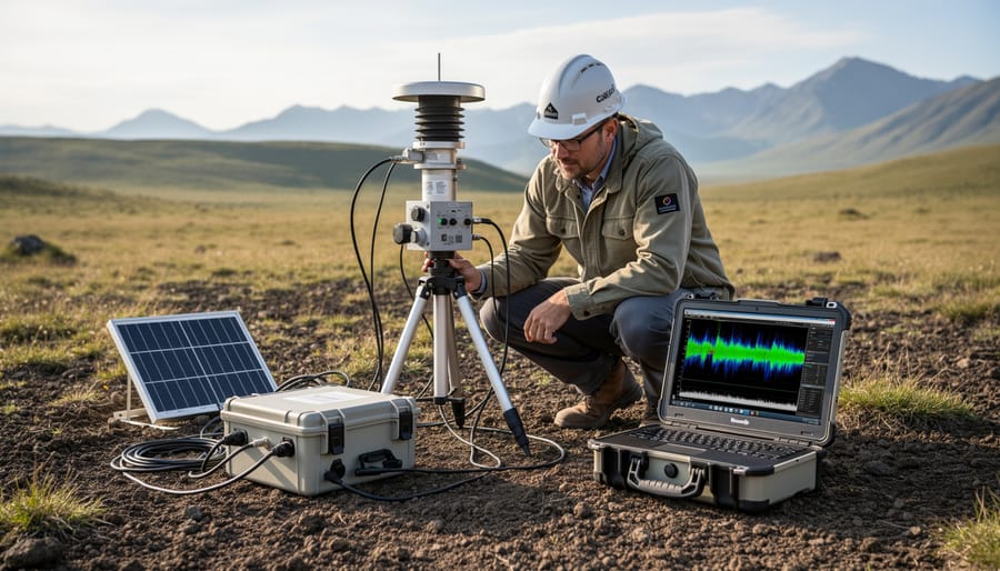
Measuring seismic activity requires a global network of sensitive instruments working in concert. Seismographs, devices that record ground motion, form the backbone of detection systems operated by universities, geological surveys, and research institutions worldwide. Modern seismometers contain pendulums or spring-mounted masses that remain stationary while the ground moves around them, converting physical motion into electrical signals. These instruments can detect vibrations smaller than the width of a human hair.
When an earthquake occurs, seismologists analyze data from multiple stations to pinpoint its location through a process called triangulation. By comparing when seismic waves arrive at different stations and understanding how seismometers relate to wave propagation, researchers calculate the epicenter and depth with remarkable precision. P-waves arrive first, followed by slower S-waves, and the time difference between them reveals how far away the earthquake originated.
Magnitude determination relies on measuring wave amplitudes and frequencies recorded across the network. Researchers use various scales, moment magnitude being most common for larger events, that account for energy release, fault rupture area, and rock displacement. Advanced data analysis in Earth science now incorporates machine learning algorithms that can identify patterns invisible to human observers, improving detection of small events and aftershock sequences.
Real-time monitoring has transformed seismic science. Data streams continuously from thousands of stations to central processing centers where automated systems flag significant activity within seconds. Government agencies and universities share information through international networks, enabling rapid emergency response and collaborative research. This interconnected infrastructure means a seismic event in one country immediately becomes available for analysis by scientists worldwide, accelerating our understanding of how Earth’s crust behaves.
Real-World Applications and Uses
Earthquake Early Warning Systems
Earthquake early warning systems leverage seismic networks to detect P-waves, the fastest-moving seismic waves, and transmit alerts before slower, more destructive S-waves and surface waves arrive. This time gap, typically seconds to tens of seconds, allows automated systems to shut down critical infrastructure like gas pipelines and transit systems, while giving people precious moments to take protective action. Natural Resources Canada has developed earthquake early warning initiatives specifically designed to protect people and infrastructure from earthquakes, building on decades of real-time seismic monitoring across the country’s seismically active regions. These systems process data from dense seismometer arrays, calculating an earthquake’s location, magnitude, and expected ground motion intensity within seconds of rupture initiation. While the warning time depends on distance from the epicenter, even brief alerts significantly reduce injuries and equipment damage by triggering pre-programmed emergency responses before severe shaking begins.
Seismic Hazard Maps and Building Safety
Seismic hazard maps translate decades of seismic monitoring data into practical tools that save lives and protect property. These maps estimate the probability of ground shaking at different intensities across geographic regions, based on historical earthquake records, known fault lines, and geological conditions. In Canada, seismic hazard maps integrated into the National Building Code provide engineers and architects with the information they need to design structures that can withstand expected ground motion in each location.
The maps work by combining seismicity records with geological knowledge to model potential earthquake scenarios. Researchers analyze where faults lie, how often they’ve produced earthquakes in the past, and what magnitude events they might generate. This analysis produces probability curves showing the likelihood of various shaking levels over specific time periods, typically 50 years for building design purposes.
Building codes then use these hazard estimates to set minimum construction standards. Structures in high-risk zones require stronger foundations, flexible framing systems, and reinforcement details that allow buildings to sway without collapsing. Hospitals, schools, and emergency facilities often must meet even stricter standards since they’re critical during disasters.
The science behind these maps continues advancing through better seismic networks and computational methods. Tools like AI in earthquake science now help researchers process vast datasets to refine hazard models and identify previously unrecognized risks, making future maps more accurate and communities more resilient.
Frequently Asked Questions
Readers often have specific questions about specialized terms and practical applications in seismology. These frequently asked questions address the most common queries about seismic activity and its real-world implications.
What is induced seismicity?
Induced seismicity refers to seismicity caused by human activity, including operations like hydraulic fracturing, reservoir impoundment, mining, and geothermal energy production. These activities can alter stress conditions in the crust, triggering earthquakes that wouldn’t otherwise occur.
What is micro-seismicity and why does it matter?
Micro-seismicity is generally defined as seismicity of magnitude less than 3, typically too small for people to feel. Scientists monitor these tiny events because they reveal active fault zones and help predict where larger earthquakes might occur.
How do earthquake early warning systems work?
Early warning systems detect the fast-moving P-waves from an earthquake and send alerts before the destructive S-waves and surface waves arrive, giving people seconds to minutes to take protective action. Natural Resources Canada issues guidance on earthquake early warning to protect people and infrastructure from earthquakes.
How are seismic hazard maps used?
Seismic hazard maps estimate the likelihood and intensity of ground shaking in different regions, informing building codes and land-use planning. Canada’s National Building Code seismic hazard maps help engineers design structures that can withstand expected earthquake forces in specific locations.
The answers to these questions draw directly from decades of research by university research networks that continuously refine our understanding of seismic processes. As monitoring technology improves and data-sharing between institutions expands, scientists develop increasingly sophisticated tools to assess seismic risk and protect communities. The collaboration between government agencies, academic researchers, and engineering professionals ensures that knowledge about seismic activity translates into practical safety measures that save lives and reduce property damage during earthquakes.
Understanding seismic activity goes far beyond academic curiosity. It’s fundamental to keeping communities safe, designing resilient infrastructure, and advancing our knowledge of Earth’s dynamic processes. When scientists accurately measure and interpret seismic events, engineers can design buildings that withstand ground shaking, planners can zone land appropriately, and emergency responders can prepare effective protocols.
The progress in seismic science over recent decades gives genuine cause for optimism. Real-time monitoring networks now detect tremors within seconds. Earthquake early warning systems provide precious moments to shut down critical systems and take protective action. Seismic hazard maps inform building codes that save lives during major earthquakes. Each advance represents collaboration between universities, government agencies, and research institutions committed to translating seismological knowledge into practical protection.
What makes this field particularly exciting is its continued evolution. University researchers are refining detection algorithms, improving hazard models, and developing innovative monitoring technologies. As our understanding deepens and tools become more sophisticated, our ability to coexist safely with seismic activity strengthens. The ongoing contributions from the scientific community ensure that tomorrow’s earthquake preparedness will surpass today’s capabilities.