
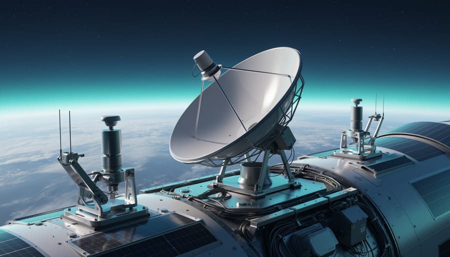
Innovations in aerospace represent the cutting-edge technologies and engineering advances that enable safer, more efficient, and more sustainable flight, space exploration, and atmospheric research. These breakthroughs span everything from hypersonic propulsion systems and autonomous flight controls to advanced materials that withstand extreme conditions and satellite networks that monitor Earth’s climate in unprecedented detail.
The significance of aerospace innovation extends far beyond the industry itself. Modern aircraft designs reduce fuel consumption and emissions, directly addressing climate challenges. Satellite constellations provide critical data for weather forecasting, disaster response, and scientific research. Reusable rocket technology has transformed the economics of space access, opening doors for commercial spaceflight and ambitious missions to Mars and beyond. As Dr. Elena Martinez, an aerospace systems engineer at NASA’s Langley Research Center, puts it: “We’re not just building better planes and rockets. We’re creating tools that help us understand our planet, predict environmental changes, and expand humanity’s presence beyond Earth.”
This article examines how aerospace innovations function at both technical and operational levels, categorizes the major technology types reshaping the field, and explores their real-world applications across commercial aviation, space exploration, and atmospheric science. Whether you’re a student curious about career paths, a researcher tracking technological trends, or simply fascinated by how we push the boundaries of flight, understanding these innovations reveals how engineering ingenuity addresses some of our most pressing challenges while reaching for seemingly impossible goals.
What Aerospace Innovations Mean for Atmospheric Sciences
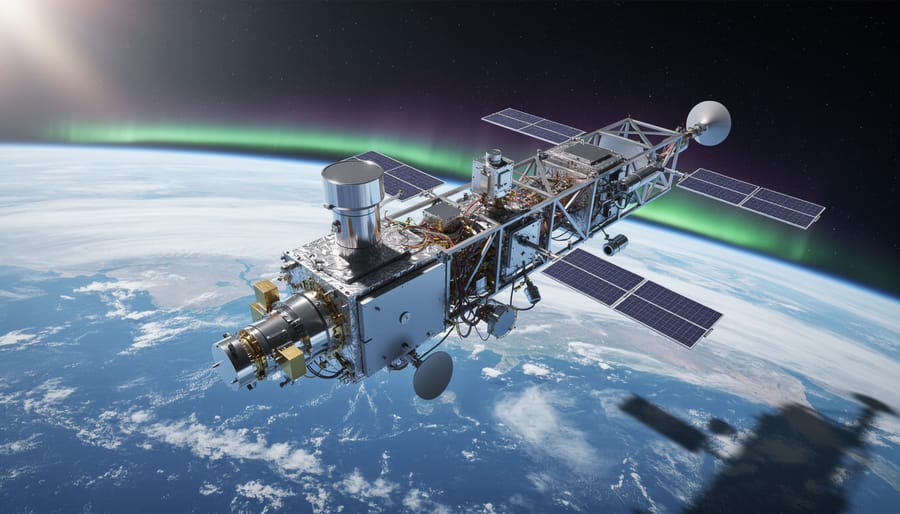
Aerospace innovations in atmospheric sciences represent the technologies and platforms that operate above Earth’s surface to gather data about the composition, structure, and behavior of our atmosphere. Unlike weather stations anchored to the ground or balloons released once daily, these systems continuously observe vast regions of the atmosphere from unique vantage points that were impossible to access just decades ago.
The toolkit includes sophisticated satellite constellations orbiting hundreds of kilometers above Earth, specialized aircraft capable of flying through the stratosphere, and autonomous drones that can hover for days at altitudes where commercial jets cannot operate. Space-based observation platforms carry instruments that measure everything from temperature and humidity to trace gases present in parts per trillion, creating a three-dimensional picture of atmospheric processes as they unfold.
- Satellite Remote Sensing
- The use of orbiting spacecraft equipped with sensors that measure electromagnetic radiation reflected or emitted by the atmosphere, allowing scientists to map temperature, moisture, cloud properties, and chemical composition without physical contact.
- LiDAR Systems
- Light Detection and Ranging instruments that send laser pulses through the atmosphere and analyze the returned signals to measure aerosol layers, cloud heights, wind speeds, and atmospheric density with high vertical resolution.
- Atmospheric Profilers
- Instruments aboard aircraft or satellites that measure vertical slices through the atmosphere, revealing how temperature, pressure, and composition change from ground level to the upper stratosphere.
- CubeSats
- Small, standardized satellites roughly the size of a shoebox that can be launched in constellations to provide frequent atmospheric observations at a fraction of traditional satellite costs.
- Stratospheric Platforms
- High-altitude aircraft, balloons, and solar-powered drones operating between 15 and 50 kilometers altitude where they can sample the ozone layer and upper atmosphere directly.
What sets these aerospace tools apart from traditional ground-based meteorological instruments is their ability to provide global coverage, continuous monitoring, and access to atmospheric layers that would otherwise remain invisible to researchers. A single polar-orbiting satellite can observe the entire planet within days, tracking weather systems as they develop over remote oceans or measuring pollution transport across international borders.
These technologies matter because the atmosphere doesn’t respect geographical boundaries or operate on human schedules. Climate change requires us to track subtle shifts in greenhouse gas concentrations across every latitude and longitude. Weather prediction depends on knowing the precise temperature and moisture profile at multiple levels of the atmosphere, not just what’s happening at one weather station. Atmospheric chemistry studies need to measure reactive compounds that exist for mere hours before transforming into something else. Aerospace platforms make all of this possible in ways that were simply beyond reach when atmospheric sciences relied primarily on ground observers and occasional research flights.
How Aerospace Technologies Advance Atmospheric Research
Space-Based Observation Systems
Satellites orbiting hundreds to thousands of kilometers above Earth’s surface collect atmospheric data through three primary methods that work together to build comprehensive pictures of our atmosphere’s composition and behavior.
Remote sensing instruments measure electromagnetic radiation reflected or emitted by atmospheric molecules. Passive sensors detect sunlight bouncing off clouds and aerosols, while active sensors emit their own signals, like radar pulses, and analyze what returns. This approach reveals cloud structure, precipitation patterns, and atmospheric temperature profiles without physically touching the air being measured.
Spectroscopy breaks incoming light into its component wavelengths, creating a fingerprint that identifies specific gases. Each molecule absorbs and emits light at characteristic frequencies: carbon dioxide shows distinct spectral signatures near 1.6 and 2.0 micrometers, while methane appears around 1.65 micrometers. NASA’s Orbiting Carbon Observatory-3 (OCO-3), mounted on the International Space Station, uses this technique to map carbon dioxide concentrations with unprecedented spatial resolution, tracking emissions from individual power plants and cities.
Imaging technologies capture visual and infrared pictures that track phenomena from smoke plumes to polar stratospheric clouds. The European Space Agency’s Sentinel-5P satellite combines imaging with spectroscopy to monitor air pollutants including nitrogen dioxide, sulfur dioxide, and formaldehyde across the entire planet daily. Its TROPOMI instrument detects pollution sources as small as individual factories, providing data that researchers use to verify emission inventories and study atmospheric chemistry in real time.
Aerial and Stratospheric Platforms
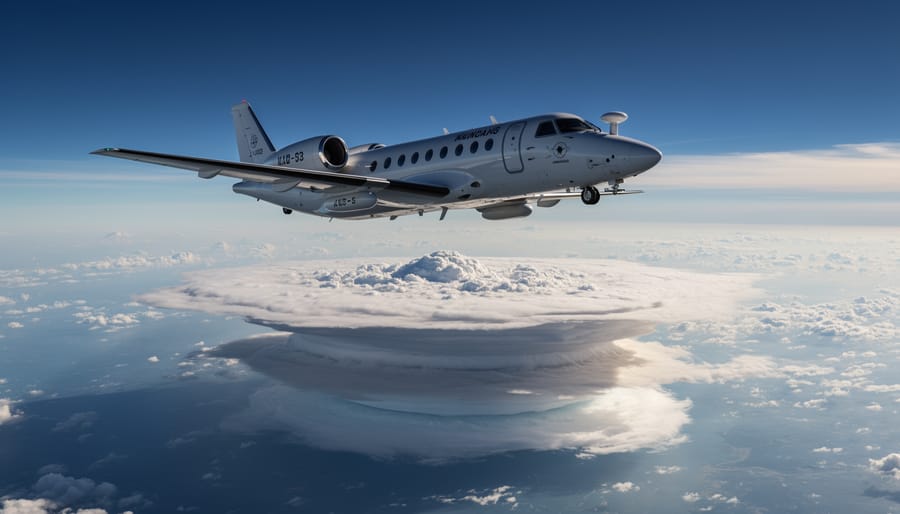
High-altitude aircraft, weather balloons, and stratospheric drones fill a critical measurement gap that satellites leave open. While orbital platforms excel at broad coverage, they struggle to capture detailed vertical profiles of atmospheric layers or conduct direct sampling of air masses. That’s where these aerial platforms prove indispensable.
Research aircraft like NASA’s ER-2 and WB-57 fly at altitudes exceeding 20 kilometers, positioning instruments directly within the stratosphere. These crewed platforms carry sophisticated sensor packages that measure trace gases, aerosols, and atmospheric chemistry in real time. Unlike remote sensing, this in-situ approach collects actual air samples, providing ground-truth data that validates satellite observations and refines atmospheric models.
Weather balloons remain workhorses of vertical profiling despite their age. Launched twice daily from hundreds of stations worldwide, radiosondes transmit temperature, pressure, humidity, and wind data as they ascend through the troposphere and lower stratosphere. Modern balloons carry miniaturized ozone sensors and particle counters that map pollution transport and stratospheric intrusions.
Stratospheric drones represent the newest platform category. These long-endurance autonomous aircraft can station-keep for days at altitudes around 20 kilometers, continuously sampling atmospheric layers that change too rapidly for balloon snapshots to capture. Their persistence enables researchers to track diurnal cycles in photochemistry and observe how the stratosphere responds to sudden events like volcanic eruptions or wildfire smoke injections.
Sensor and Instrument Technologies
Miniaturization has revolutionized atmospheric measurement capabilities aboard aerospace platforms. Modern sensors weigh mere grams yet match or exceed the precision of ground-based instruments that once occupied entire laboratories. Microelectromechanical systems (MEMS) now pack multiple sensing functions, temperature, pressure, humidity, into single chips, enabling dense sensor arrays on small satellites and drones.
Compact spectrometers have transformed trace gas detection. Cavity ring-down spectroscopy instruments, shrunk from refrigerator-sized units to briefcase dimensions, measure carbon dioxide and methane concentrations with parts-per-billion accuracy from stratospheric altitudes. Quantum cascade lasers provide similar sensitivity in even smaller packages, opening new possibilities for CubeSat atmospheric chemistry missions.
Onboard computational power determines what data reaches the ground. Edge computing processors now analyze raw sensor readings in real time, transmitting only scientifically valuable measurements rather than overwhelming bandwidth with unprocessed data. Machine learning algorithms running aboard satellites identify atmospheric phenomena autonomously, directing instruments toward transient events like volcanic plumes or methane releases without waiting for ground commands.
Categories of Aerospace Innovations in Atmospheric Sciences
Next-Generation Satellite Constellations
Small satellites, often no larger than a shoebox, are rewriting the economics and capabilities of atmospheric monitoring. Traditional weather satellites, while powerful, orbit alone and revisit the same location only once or twice per day. CubeSat constellations flip this model: dozens of identical miniature satellites work as a coordinated network, scanning Earth continuously.
Planet Labs operates over 200 CubeSats that image the entire planet daily at three-meter resolution, capturing atmospheric phenomena like wildfire smoke plumes and volcanic ash dispersal in near real-time. For greenhouse gas tracking, companies like GHGSat deploy methane-detecting microsatellites that pinpoint industrial emissions down to individual facilities, something impossible with conventional polar orbiters.
The temporal advantage matters enormously. Carbon dioxide concentrations change hour by hour as cities wake, traffic peaks, and power plants ramp up. A constellation observing the same region four times daily reveals these diurnal patterns, letting researchers separate natural emissions from human activity. MethaneSAT, launching in 2024, will map global methane sources every week with resolution sufficient to identify leaking pipelines.
Universities now build atmospheric CubeSats for under two million dollars, democratizing space-based research. This proliferation means more eyes on the atmosphere than ever before, filling gaps between major agency missions.
Advanced Remote Sensing Technologies
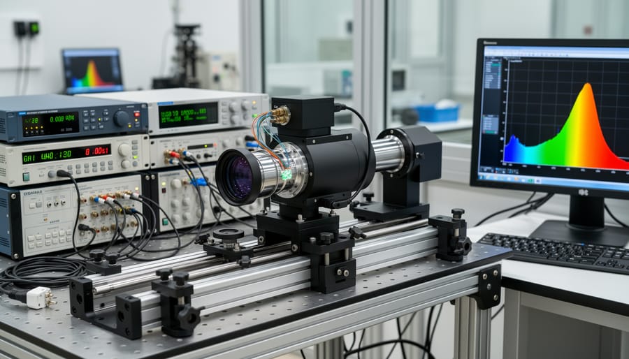
LiDAR (Light Detection and Ranging) systems mounted on satellites and aircraft emit laser pulses that bounce off atmospheric particles, revealing vertical profiles of clouds, aerosols, and dust layers with centimeter-scale precision. NASA’s CALIPSO satellite uses this technology to track smoke plumes crossing continents and measure ice crystal properties within clouds, data impossible to obtain from ground-based instruments alone.
Synthetic aperture radar penetrates clouds and darkness, capturing atmospheric moisture patterns and wind fields over oceans where weather stations don’t exist. These microwave sensors detect subtle changes in atmospheric water vapor that signal developing storms hours before they become visible.
Hyperspectral imaging breaks atmospheric light into hundreds of narrow wavelength bands, creating detailed “fingerprints” of gases like nitrogen dioxide, sulfur dioxide, and methane. The TROPOMI instrument aboard Europe’s Sentinel-5P satellite maps pollution sources at neighborhood scales, distinguishing emissions from power plants, factories, and vehicle traffic.
Modern spectrometers now measure trace gases at parts-per-trillion concentrations from space, sensitivities that seemed impossible a decade ago. This technological leap lets researchers track atmospheric chemistry reactions in real time, revealing how pollutants transform during transport and interact with natural compounds.
Autonomous Atmospheric Research Platforms
Uncrewed aircraft systems now operate at altitudes and durations impossible for piloted missions, collecting atmospheric samples where satellites lack resolution and ground stations can’t reach. Long-endurance drones like NASA’s Global Hawk fly 20-hour missions through tropical cyclones and Arctic air masses, measuring temperature, humidity, and trace gases with centimeter-scale precision across thousands of vertical feet.
Autonomous gliders represent a particularly transformative class of platform. These aircraft adjust their flight paths in real time based on atmospheric conditions they detect, following pollution plumes to their sources or tracking rapidly evolving weather fronts without human intervention. Machine learning algorithms onboard can identify atmospheric features of scientific interest, a sudden methane spike, an unexpected temperature inversion, and redirect the platform to investigate before the phenomenon dissipates.
Stratospheric balloons with AI-guided steering systems now maintain station over specific regions for weeks, something traditional weather balloons could never achieve. These platforms carry miniaturized mass spectrometers and particle counters that provide continuous atmospheric composition profiles, filling critical gaps between sporadic satellite overpasses and stationary ground monitors. The combination of extended loiter capability and adaptive sampling creates datasets that capture atmospheric processes as they unfold rather than offering mere snapshots.
Data Processing and AI Integration
The volume of atmospheric data streaming from satellites and airborne sensors far exceeds what researchers can manually analyze. AI for environmental data processing now automates pattern recognition in complex datasets, identifying pollution events, tracking atmospheric fronts, and detecting subtle signals of climate change that would otherwise remain hidden. Cloud computing infrastructure enables real-time processing of terabytes of sensor readings, transforming raw measurements into immediately usable atmospheric products. Machine learning models trained on historical observations can predict where and when to sample next, optimizing flight paths for research aircraft.
Applications in Atmospheric Research and Monitoring

Climate Science and Carbon Cycle Studies
Satellite missions now provide unprecedented views of Earth’s carbon cycle that were impossible from ground stations alone. NASA’s Orbiting Carbon Observatory-2 (OCO-2), launched in 2014, circles the planet capturing over 100,000 measurements daily of atmospheric CO₂ concentrations with precision better than 1 part per million. Its successor, OCO-3, mounted on the International Space Station, adds flexible targeting that reveals carbon emissions from individual cities and power plants, data that validates national emissions inventories and catches discrepancies between reported and actual output.
The European Space Agency’s Sentinel-5P satellite tracks methane plumes worldwide, identifying leaks from oil and gas infrastructure that account for substantial unreported emissions. These space-based observations feed directly into climate models, constraining uncertainties about carbon sources and sinks that plagued earlier projections. Researchers can now distinguish fossil fuel emissions from natural respiration, watch seasonal carbon uptake by forests, and spot unexpected sources like thawing permafrost.
Japan’s GOSAT mission demonstrated how precise greenhouse gas monitoring offers hope for climate action through accountability. Combined with AI in climate solutions that process petabytes of satellite data, these platforms transform abstract emissions targets into verifiable reality, giving policymakers the evidence needed to track progress and adjust strategies.
Weather Prediction and Severe Storm Research
Satellites fundamentally changed how forecasters see developing storms. Geostationary weather satellites now deliver full-disk images every 30 seconds during severe weather events, capturing the rapid evolution of thunderstorm tops and wind shear patterns that signal tornado formation. NOAA’s GOES-16 and GOES-17 satellites provide 16 spectral channels compared to five on previous generations, allowing meteorologists to distinguish between ice crystals, supercooled water, and hail within storm clouds, critical indicators of severity.
High-altitude aircraft like NOAA’s Hurricane Hunters fly directly into tropical cyclones, deploying dropsondes that measure temperature, pressure, humidity, and wind speed from flight altitude down to the ocean surface. These vertical profiles, impossible to obtain from satellites alone, improve hurricane track forecasts by 15-20 percent and intensity predictions significantly. “The dropsonde data fills gaps in our understanding of the storm’s inner structure that satellites simply can’t resolve,” explains Dr. James Franklin, former chief of NOAA’s Hurricane Specialist Unit.
Polar-orbiting satellites contribute microwave soundings that penetrate clouds, revealing atmospheric temperature and moisture profiles used to initialize the numerical weather models running on supercomputers. This three-dimensional atmospheric snapshot, updated every six hours globally, forms the foundation of modern five-day forecasts that now match the accuracy of three-day forecasts from the 1990s.
Air Quality and Pollution Monitoring
Aerospace platforms have revolutionized air quality monitoring by providing real-time pollution data across entire metropolitan regions, a feat impossible with ground stations alone. NASA’s TEMPO (Tropospheric Emissions: Monitoring of Pollution) mission, launched in 2023, scans North America hourly to map nitrogen dioxide, ozone, and formaldehyde concentrations with neighborhood-level precision. This geostationary satellite helps cities issue health advisories before smog events peak and pinpoints industrial facilities or highways contributing disproportionately to local pollution.
The European Space Agency’s Sentinel-5P satellite tracks aerosol transport from wildfires and desert dust storms, showing how pollution crosses borders and affects communities hundreds of miles downwind. During California’s 2024 wildfire season, satellite data guided public health officials in issuing evacuation orders and shelter-in-place warnings based on smoke plume trajectories. “We can now see pollution move in near-real-time and predict exposure hours before it arrives,” notes Dr. Susan Anenberg, an environmental health researcher at George Washington University. These capabilities represent significant climate research wins in protecting vulnerable populations from air quality hazards.
Atmospheric Chemistry and Ozone Research
Space-based spectrometers measure ultraviolet absorption by stratospheric ozone, documenting the gradual healing of the Antarctic ozone hole since the Montreal Protocol banned chlorofluorocarbons. Instruments like NASA’s Ozone Mapping and Profiling Suite track daily ozone variations at unprecedented resolution, while atmospheric limb sounders profile nitrogen dioxide, chlorine monoxide, and other reactive molecules that control ozone chemistry. These same sensors monitor tropospheric pollutants, formaldehyde, sulfur dioxide, nitrogen oxides, revealing how industrial emissions and wildfires trigger photochemical smog formation. Satellite data now feeds directly into air quality forecasts for cities worldwide.
Future Directions and Emerging Technologies
The next decade promises a wave of aerospace technologies that will deepen our atmospheric science capabilities beyond today’s systems. Small satellite swarms, dozens or even hundreds of coordinated CubeSats flying in formation, will replace single, expensive platforms with distributed networks that capture simultaneous measurements across wide regions. These constellations can track rapidly evolving atmospheric phenomena like dust storms or volcanic plumes in near real-time, closing gaps that traditional satellites miss between revisit passes.
Sensor development is pushing toward molecular-level precision. Quantum cascade lasers and photonic spectrometers, small enough to fit on cube satellites, will measure trace gases at parts-per-trillion sensitivity, revealing subtle chemical signals that current instruments cannot detect. Advanced LiDAR systems using new wavelength combinations will profile atmospheric layers with centimeter-scale vertical resolution, uncovering fine structures in cloud boundaries and aerosol distributions that shape weather and climate feedback loops.
Commercial spaceflight is opening atmospheric research to university labs and smaller agencies that lacked access to costly government launches. Reusable rockets and ride-share missions have slashed costs, enabling more frequent experiments and faster iteration on sensor designs. Private companies are deploying constellations for weather forecasting and environmental monitoring, generating datasets that complement publicly funded missions and accelerate the pace of discovery.
Integration with ground-based networks will amplify these aerospace advances. When satellite observations merge with data from surface sensors, radar installations, and autonomous ocean buoys, scientists can validate space-based measurements and fill in the vertical gaps between Earth’s surface and orbital altitudes. Machine learning pipelines, potentially enhanced by breakthroughs in quantum and Earth science computation, will assimilate this flood of heterogeneous data into unified atmospheric models, revealing patterns too complex for conventional analysis and sharpening our ability to predict and respond to environmental change.
How Innovations in Aerospace Works
At their core, aerospace innovations transform atmospheric observation through a chain of interconnected capabilities: deployment, measurement, transmission, and analysis.
The process begins when aerospace platforms, whether satellites orbiting at specific altitudes or aircraft flying through target atmospheric layers, position advanced sensors where they can interact with atmospheric constituents. These sensors employ techniques like spectroscopy, which measures how sunlight or emitted radiation interacts with gas molecules, revealing their concentration and chemical identity. A satellite spectrometer, for instance, detects the unique absorption patterns of carbon dioxide at 15 micrometers wavelength, distinguishing it from other atmospheric gases.
Once captured, raw measurements flow through onboard processors that perform initial calibration and compression before transmitting data to ground stations via radio frequencies. Ground systems then apply sophisticated algorithms that correct for viewing angles, cloud interference, and instrument drift, transforming raw signals into scientifically validated datasets.
The final step integrates these measurements with numerical models. Atmospheric scientists assimilate satellite-derived wind speeds, temperature profiles, and chemical concentrations into weather prediction or climate models, constraining uncertainties and improving forecast accuracy. This feedback loop between observation and modeling creates an iterative refinement process, where better aerospace data produces better models, which in turn guide the design of next-generation sensors targeting remaining knowledge gaps.
Frequently Asked Questions
How accurate are satellite atmospheric measurements compared to ground-based observations?
Modern satellite sensors achieve accuracy within 1-2% for many atmospheric parameters like carbon dioxide concentration, matching or exceeding ground station precision. The advantage lies in satellites’ ability to provide global coverage and measure remote regions where ground instruments are absent, though ground measurements remain essential for validating and calibrating satellite data.
Can researchers and the public access aerospace atmospheric data?
Most government space agencies provide free, open access to atmospheric satellite data through online portals, NASA’s Earthdata, ESA’s Copernicus, and NOAA’s data centers all offer datasets within hours of collection. Researchers worldwide use these resources, and simplified visualizations make key atmospheric metrics accessible to educators and the general public.
How do aerospace and ground-based atmospheric research complement each other?
Aerospace platforms excel at spatial coverage and measuring upper atmospheric layers, while ground stations provide continuous temporal monitoring and higher vertical resolution near the surface. Scientists integrate both approaches: satellites identify pollution hotspots or atmospheric anomalies across continents, then ground instruments conduct detailed local analysis of chemical processes and temporal variations.
What are the main challenges facing aerospace-based atmospheric research?
Cost remains a primary barrier, launching and maintaining satellites requires substantial investment, though small satellite technology is reducing expenses. Other challenges include sensor calibration over mission lifetimes, distinguishing atmospheric signals from surface reflections, processing massive data volumes, and coordinating measurements across different platforms to create comprehensive atmospheric pictures.
International collaboration has become fundamental to aerospace atmospheric research, with countries pooling resources and expertise to tackle global atmospheric questions. The European Space Agency’s Copernicus program combines contributions from multiple nations, while initiatives like the Committee on Earth Observation Satellites coordinate atmospheric monitoring strategies across American, European, Japanese, Chinese, and Indian space agencies. This cooperation ensures continuous global coverage as different satellites orbit Earth, and shared data protocols allow researchers worldwide to combine measurements from various platforms into unified atmospheric analyses.
The integration of artificial intelligence with aerospace atmospheric data represents another transformative development addressing practical challenges. Machine learning algorithms now process satellite observations in near-real time, identifying atmospheric patterns that would take human analysts weeks to recognize. Understanding how AI works in this context helps clarify how computers learn to distinguish genuine atmospheric signals from sensor noise, cloud interference, and surface reflections, a capability that dramatically improves data quality and makes aerospace observations more reliable for operational forecasting and research applications.
Aerospace innovations have fundamentally transformed atmospheric sciences, converting what was once a largely ground-based observational discipline into a truly three-dimensional, global research enterprise. The synergy between aerospace engineering and atmospheric research continues to accelerate, with each breakthrough in sensor technology, satellite design, or data processing opening new windows into Earth’s atmospheric processes.
These technologies have proven indispensable for tackling humanity’s most pressing environmental challenges. Real-time monitoring of greenhouse gases, unprecedented resolution in tracking pollution sources, and improved severe weather forecasting all depend on the aerospace platforms discussed throughout this article. As Dr. Sarah Chen of the National Center for Atmospheric Research notes, “We’re no longer limited by where we can physically place instruments, we can now measure atmospheric composition anywhere on Earth, continuously.”
Looking ahead, the democratization of space access and continued miniaturization of sensors promise even more sophisticated atmospheric observation capabilities. Commercial aerospace ventures are lowering costs, enabling research institutions worldwide to deploy their own atmospheric monitoring missions. This technological evolution positions us to better understand climate dynamics, protect air quality, and develop more accurate predictive models. The marriage of aerospace innovation and atmospheric science has redefined what’s possible in understanding our planet’s delicate atmospheric envelope.